
Underground Utility Locating
Professional electromagnetic locating, ground penetrating radar, pipe camera inspection, and conduit investigation — performed with industry-leading equipment and delivered with documentation you can act on. Every locate is approached with the same standard: find it, mark it, report it accurately.
Fully Insured — COI Available Upon Request | OSHA 30 Certified | TWIC Card Holder — Port and Federal Facility Access Available
The Right Method for Every Condition
No two sites are the same. Soil conditions, utility materials, depth, and access all determine which locating method — or combination of methods — delivers the most reliable results. We utilize Radio Detection equipment and ground penetrating radar based on what the job requires, not a one-size-fits-all approach. Every locate is documented with surface markings, depth estimations, field photographs, and a written report.

A lot of what's underground never shows up on a standard locate. Plastic water lines, PVC conduit, clay sewer pipe, fiber with no tracer wire, septic tanks, buried fuel and oil tanks, old foundations — none of it carries a signal, so standard electromagnetic equipment walks right past it. GPR scans straight through the ground and finds it anyway, without disturbing a single inch of surface.
If you're trying to figure out where something is before you break ground, this is the tool for it.
What GPR finds:
-
Non-metallic pipe — PVC, HDPE, clay, concrete, and plastic gas or water lines
-
Utilities with no tracer wire and no way to attach a signal
-
Septic tanks, cisterns, and buried (underground) fuel and oil tanks
-
Rebar, conduit, and post-tension cable inside concrete slabs — before you cut or core
-
Voids, sinkholes, and disturbed soil
-
Old foundations, buried debris, and forgotten structures
When to call:
-
Before any excavation, trenching, boring, or grading on private property
-
Before cutting or coring a slab, driveway, or foundation
-
When 811 stops at the meter and you still need to know what's on your side of the line
-
When the metal's already located and you need to confirm nothing was missed
-
When the as-builts are wrong, outdated, or don't exist at all
Serving Savannah and the Coastal Empire. If it's buried and you need to know where — before you dig, cut, or core — that's the call to make.
-
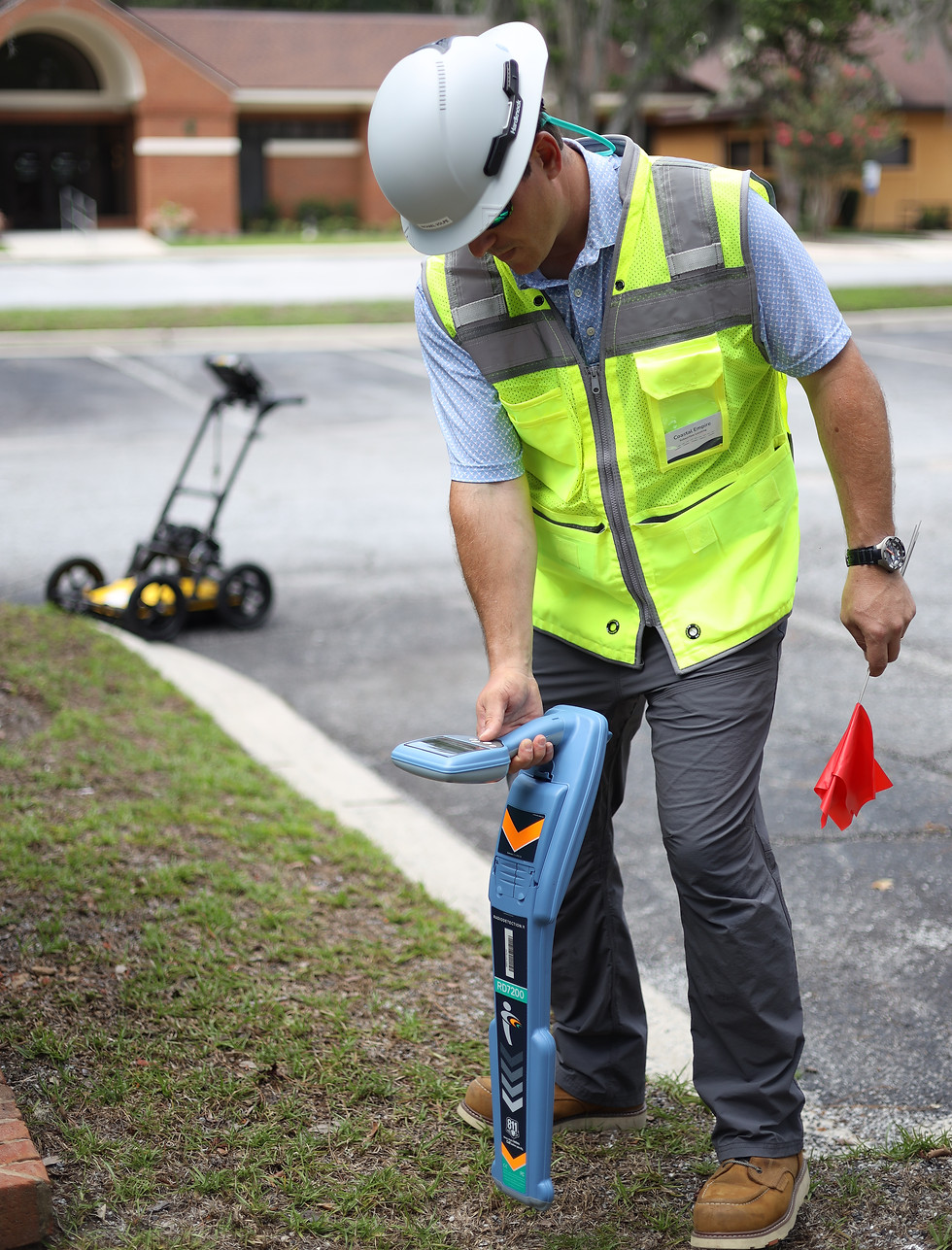
Radiodetection Equipment
This is the workhorse of utility locating. A signal is applied to a buried line, and the line's exact path and depth are traced from the surface — no guessing, no digging to find out. If it's metal, or it carries a tracer wire, or a signal can be put on it, EM locating maps it precisely.
It's the first tool out of the truck on most jobs, and on conductive lines there's nothing more accurate for pinning down where a line runs and how far down it sits before you put a shovel, an auger, or a fence post in the ground.
What EM locating finds:
-
Buried power and electrical lines
-
Telephone, cable, and fiber where a tracer is present
-
Metallic water and gas lines
-
Steel, copper, and metal pipe of any kind
-
Tracer wires on plastic gas, water lines, and conduit
-
Sewer, drain, and septic lines — traced with a sonde or traceable rod
-
Power and water runs to sheds, docks, pools, wells, and outbuildings
-
When to call:
-
Before digging, trenching, boring, grading, or driving stakes and fence posts on private property
-
When 811 stops at the meter and the lines on your side still need marking
-
When you need the exact path and depth of a specific line — to avoid it or to tie into it
-
Before landscaping, fencing, tree planting, or any project that breaks ground
-
When a line needs to be found and marked before someone hits it
-

Traceable Duct Rodder
Not every underground line is on a drawing. Abandoned conduit, undocumented installs, legacy systems, and lines put in with no as-built records turn up on properties of every type — and you usually find out the hard way. When the routing of an unknown line has to be established before work starts, a traceable rod is fed through an accessible entry point to put a detectable signal directly into the line.
From there the path is traced from the surface — routing, approximate depth, where the line terminates, and in many cases breaks, separations, or blockages along the run. Where pipe camera access is available, the camera and rod go in together: the rod establishes the signal path from the surface while the camera documents interior condition from within. That dual deployment is the most complete picture of an unknown underground line available short of digging it up.
What it's used for:
-
Mapping abandoned or undocumented conduit and pipe
-
Finding where a line runs and where it comes out — entry and termination points
-
Tracing empty conduit and non-metallic duct that standard locating can't pick up on its own
-
Confirming routing before pulling new cable, fiber, or wire through existing conduit
-
Locating breaks, collapses, separations, or blockages inside a line
-
Documenting the path or condition of an underground system for renovation, insurance, or legal records
-
When to call:
-
Before excavation or renovation where unknown conduit or piping is in play
-
Before relying on existing conduit for a new pull — to confirm it's intact and where it actually goes
-
When a line isn't on any drawing and its routing has to be established first
-
When the condition of a line needs confirming before work depends on it
-

Professional Sewer Camera
You can't plan around what you can't see. A sewer lateral, a drain, an empty conduit — when something's wrong down there, or a wire or rod won't pull through, the question is always the same: what am I actually up against? A camera answers it. The head travels the inside of the line and shows the real condition — and an integrated 512 Hz sonde broadcasts a signal from inside the pipe, so the camera's position is traced and marked from the surface in real time as it goes.
That means in a single visit you get both halves of the picture: a full interior condition view of the line and a confirmed surface map of its routing and depth. Surface marks are placed at key intervals, at any defect, and at the exact point of an obstruction — so when there's a problem, you open the ground in one spot, not the whole run. When the full path needs tracing regardless of pipe condition, a traceable rod is deployed alongside the camera to mark the entire line from access point to connection.
What it's used for:
-
Sewer and drain laterals — roots, cracks, offsets, bellies, blockages, and collapses
-
Finding out why a wire or rod won't pull through a conduit — a crushed section, a break, debris, standing water, or a bad coupling
-
Confirming whether a conduit or drain is intact and usable before you rely on it for a pull
-
Pinpointing the exact location and cause of a blockage before you dig or cut
-
Pre-purchase sewer and drain due diligence
-
Storm drains, French drains, downspout and yard drains, and irrigation lines
-
Identifying pipe material and transition points along a run
When to call:
-
Before excavation near known or suspected sewer, drain, or conduit routing
-
Before any pipe or conduit repair or replacement — know the problem before you open the ground
-
When a wire or rod won't go through and you need to know what's stopping it
-
Before buying a home or property, to document sewer and drain condition up front
-
Anytime the real question is whether you're cutting concrete, chasing a collapse, or dealing with something simpler
All findings are documented with surface markings, approximate depth readings, video recording, field photographs, and a detailed written report.
-